
Destination: Melissa Coray Peak
Mileage: 11.88 round trip
Trailhead: Carson Pass on Highway 88
Elevation: 8,592 up to 9,795 feet
Timing is everything.
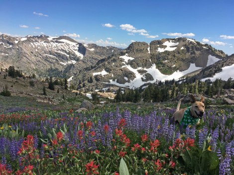
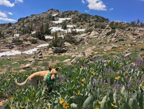
Wildflowers galore in the Sierra and one more week of freedom before resuming my regular work schedule – Aspen and I had time for one more mid-week adventure. While planning, Winnemucca Lake was on the list of options. However, I wanted a long day-hike so I looked over a map of the area for destinations. Fourth of July Lake – no, I’d rather get the climb done first and descend at the end of a hike. Fourth of July Peak – maybe, but what is this…Melissa Coray and Peak 9795?
I was curious who this Melissa character was, as I haven’t seen too many peaks named after ladies. Turns out she’s a bit of a bad ass. As the plaque on the peak states, it was “named after a heroic pioneer woman who crossed this pass in 1848 setting an example for those who followed.” There is a wealth of information on the Coray Family Society website, including that, during the march west, Melissa took to carrying a pebble in her mouth allowing her saliva to flow and stave off thirst – clever lady. During this year of empowering women outdoors, I thought this was a perfect way to honor a #ForceOfNature.
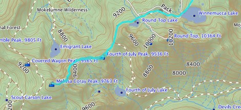
Click for larger map – PDF version.
Meandering creek – check.
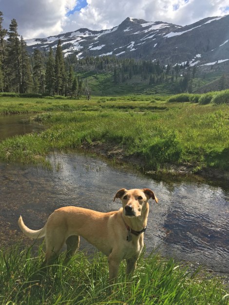
Aspen and I camped in a familiar dispersed area east of Carson Pass. There were already a few tents set up when we pulled in, but luckily the site tucked away in the back was vacant. The beauty of Peanut, our Tacoma adventure-mobile, is the lack of setup. Camp chair origami-ed together – check. Bug net unfurled – check. With that, we were ready for a stroll in the woods. We followed an old double track toward the nearest mountain and found a peaceful meadow with a creek meandering through. Oh, we also found a heaping pile of bear scat, at which point I started spouting out the next day’s plan and filled the rest of the silence with my Bon Jovi adaptation, Hiking On A Trail, as to not sneak up on any large fauna enjoying a post-poop nap.
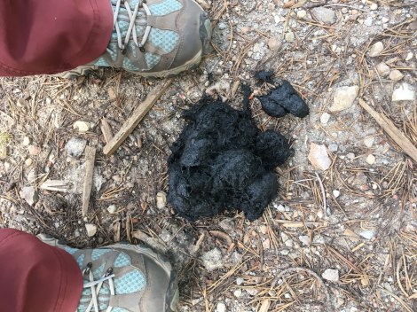
Bear scat – size 7 1/2 hiking shoe for scale.
When we returned to camp, I prepped Aspen’s dinner. I turned to ask her if she was hungry and THE HORROR! There was least 20 mosquitoes swarming her. What a day to forget the bug repellent! I swatted away the pests on her leg and five landed on her unguarded face. I swatted those away and more landed on her back! I made one last attempt to rid her of the scourge and she jumped into the back of the truck. I quickly followed after her and settled into the safety behind the bug netting.
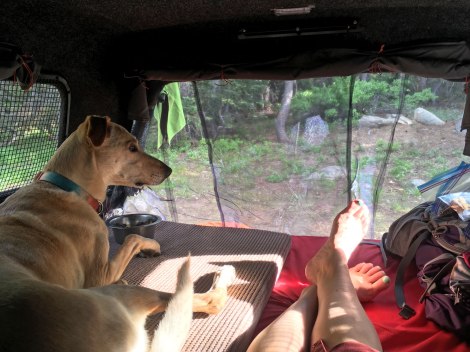
Bug net – proving to be the best adventure-mobile addition.
We parked at Carson Pass Trailhead to start this adventure, happily paid our $5 fee to the Forest Service, grabbed my backpack, and clipped the leash on Aspen. I typically avoid leash areas, but I’ve been meaning to visit Carson Pass and figured it couldn’t be too bad with the stretchy leash. Ha! Less than a mile into the hike, instead of relaxing into nature, I was ready to snap from Aspen’s constant need to be at the end of her leash tugging on my shoulder. While Aspen is an amazing adventure pup, leash skills are not her strong suit and this was not shaping up to be the pleasant day in the mountains I was after. Then I had the idea to put the handle through my waist strap. Success! Well kind of, she still had to extend the leash to the end, but the tugging was more tolerable. Next time we decide to brave a leash area, she’s wearing her harness and we’re doing the hike skijoring style!
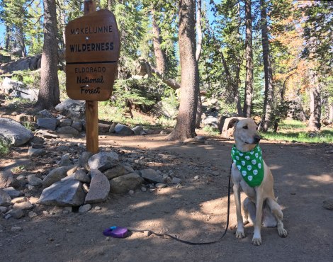
My, what a shiny new wilderness sign you have.
Frog Lake is the first lake along the route and is less than 200 feet off the trail, but I suggest saving this for the return trip. Bear with me and you’ll see why. Or if you’re impatient, scroll to the end of this post, your choice.
Frog Lake, looking south.
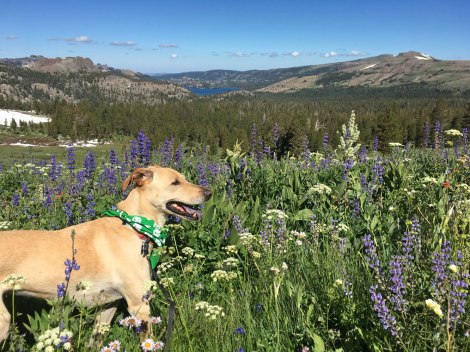
The next mile was along a mountain side with non-stop views. I suggest visiting when the wildflowers are out for top-notch scenery. There were, however, a lot of people; it was at this point that I started counting fellow hikers and dogs. At first I thought an adjective would do, but then I decided actual numbers would give you, my dear reader, a better idea of what to expect. Keep in mind this was a Thursday at the end of July.
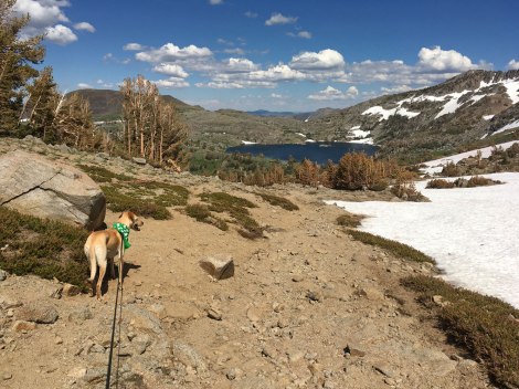
Views along the trail, including Caples Lake.
Throughout the day we saw 52 hikers and nine dogs. The vast majority between the trailhead and Winnemucca Lake. My guess is the trail is bustling even more on weekends, but you’ll have to report back as we will not be among the masses. It is not surprising that this stretch of alpine wilderness is extremely popular considering there is a fantastic alpine lake at the end of a relatively mellow hike. Even with the crowd, it is worth a visit. To leave the crowds behind, I suggest enjoying the lake during a snack break and then keep hiking.
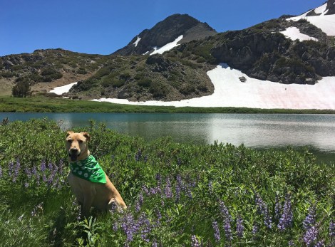
Winnemucca Lake, looking east.
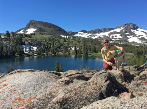
Round Top Lake is smaller than Winnemucca, but worthy of a visit with a fraction of the visitors. Once beyond the lake, we had the trail to ourselves. My original thought was actually to park at Woods Lake Trailhead and then make a loop out of Woods, Winnemucca, and Round Top Lakes, but then I set my sights on a loftier goal: the opportunity to tag three peaks sitting neatly in a row! We skirted around The Sisters, heading for the saddle to Fourth of July Peak.
Round Top Lake
Nearing the saddle to Fourth of July Peak.
There is no trail marker at the saddle for the peak, but there is a user-created trail to follow, meaning it is crude and not maintained by the Forest Service. Once the trail reached the snow, I kick stepped my way to the top. Halfway up, though, I decided it would be smarter to stick to land for the descent.
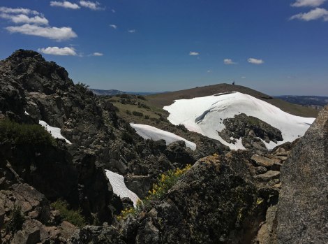
Looking south from Fourth of July Peak.
Beyond Fourth of July Peak, any sort of trail disappears. We picked our way west, skirting south along a small hill between the two peaks. I found the hardest stretch of this hike was the eastern slope of Peak 9795. We weaved through fields of granite outcrops and trees and picked our way up the scree slope for the final approach.
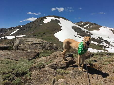
Looking west to Peak 9795.
I will admit, we didn’t tag the tippy-top because it looked a bit precarious with just Aspen and me. I’m sure mamma-bear strength would kick in if Aspen got injured and I had to carry her out, but I question her ability to channel Lassie and retrieve help for me. So we settled for having the craggy peak in our view rather than stand on it.
First glimpse of Melissa Coray Peak near summit of Peak 9795.
From 9795, it was a quick jaunt to the top of Melissa Coray Peak. The peak is wide open with 360 views, minus the antenna contraption. Silver lining though, that contraption provided a spot for a break in the shade.
Looking down at Emigrant Lake reminded me of a hike we took for Aspen’s birthday in 2014. Aspen and I were having lady adventures before force of nature was a hashtag
A quick note on the leash requirement. You may notice Aspen off-leash in a few of these photos. I’m a proponent of using Authority of the Resource to help visitors understand why there are certain rules and regulations rather than spout off codes and fine amounts. From what I could tell from a bit of internet research, the reason for the leash law is due to the high popularity of the area. A lot of people has the potential to equal a lot of impact. Once Aspen and I were traveling off trail we did not see another soul. At that point she wasn’t impacting other visitors so I let her off leash since she has good recall. I’m not recommending disregarding regulations, I just wanted to give a quick explanation for my actions. If the leash law has other reasons for being in place, it would be helpful if they were publicized in order to inspire compliance.
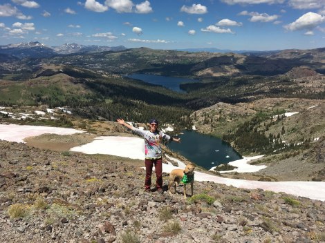
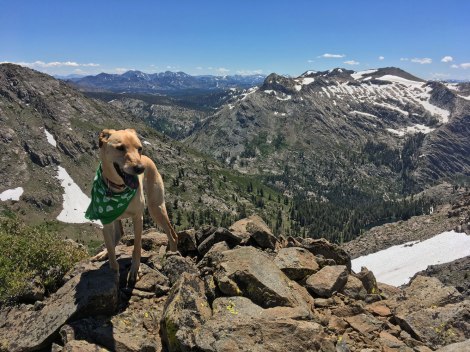
On top of Melissa Coray Peak looking down on Caples and Emigrant Lakes.
Back on top of the peak, we took a few timed photos then turned around and retraced our steps. At the junction for Frog Lake, we took a detour to the northern shore where we found a good rock that led to deeper water so I didn’t have to wade inch by inch into the cool water. I promise it wasn’t that cold anyway, well, for an alpine lake…
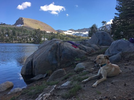
Tired pup back at Frog Lake.
Happy,
Trails

Pingback: Find Your Lupine Field | Trails' Guide·