
I sat scrunched up in a sliver of shade looking out at an expansive view with tears forming salty runnels down my cheeks. I glanced back at the rock face waiting for Route to repel down hoping he’d be able to collect all of our gear and my stupid injury wouldn’t cost us anything but a few boohoos.
A half an hour earlier, Route started up Hot Streak, a 164 ft mixed climb. Belaying at the base of the wall, I followed Aspen’s lead and sheltered in the bushes to hide from the warming sun. Once Route made it to the top and set an anchor, I prepared to climb up after him. I was just getting in my climbing groove on the lie-back start when, ever-so-gently, my right shoulder gave a little thhhuunnk then worthlessly rested on the rock. Staving off panic, I rotated my shoulder the only way it would allow – nothing. My breath quickened as horror stories of shoulder dislocations flashed in my head. I gave my shoulder a little pep talk, insuring that no one wanted to deal with the pain of a dislocation and tried rotating it again, thankfully it settled back into place. I was only three feet off the ground on the first climb of the day…dammit.
Thankfully, it wasn’t serious. Just a subluxation, which is a fancy word for an incomplete dislocation. No need to rush off to the hospital, but it did warrant some pouting for missing out on a second day of climbing in the granite wonderland known as Shuteye Ridge. The monoliths may not be as imposing or famous as those in neighboring Yosemite Valley, but they’re still impressive. The National Park can keep Half Dome and its crowds; I’ll enjoy Sierra National Forest’s Chiquita Dome with tail-wagging dogs and fewer people.
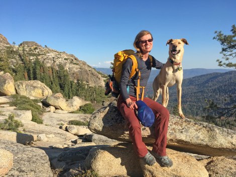
Great views on the Runnel Vision Wall approach.
There’s a wealth of information in the Shuteye Ridge guidebook by Wolverine. However, pay close attention to approaches. We hiked halfway up the mountain before realizing we weren’t even on the Shuteye Pass Trail. The Forest Service roads in the area are labeled, but the trails are not. There are cairns along the route, but are hard to spot at times and puzzling at others. And don’t get me started on Runnel Wall vs Runnel Vision Wall – not confusing to first-timers at all… For those traveling with dogs, note that the Shuteye Pass South area is steep and bouldery in some areas. Aspen is part mountain yak and made the approach successfully with a few back tracks and assists from us. Also, pay attention to the approach descriptions, as some have rappels.
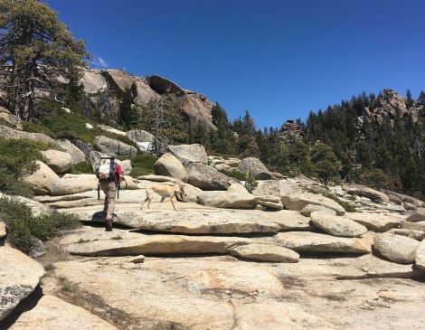
Approaching Runnel Vision Wall – not to be confused with Runnel Wall…
Runnel Vision Wall turned out to be a popular destination. The base is full of brush and boulders leaving limited space for those at the bottom of the wall. There was already three dogs and eight or so people at the east face. Thankfully, climbing pet parents tend to be a friendly group and they made room for our party of three.
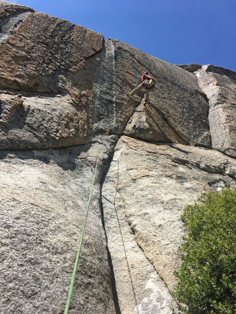
There was a line for our intended climb, so we skipped the warm up and jumped on Friendly Fire. The group at the base mentioned an awkward beginning and I can attest to that after ending up in a bush when I fell off the wall at the start. After the initial start, the face fills with rock plates and chicken heads.
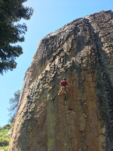
Friendly Fire – three star 5.10b
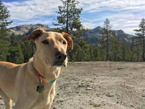
Not the worst crash-pad substitute.
Once the group cleared out, Aspen was able to appropriate a shady nook to do what crag dogs do best, relax at the bottom of a climb, and we were able to jump on the highly rated Runnel Lust. The guidebook describes the topography of this route perfectly, “A deep runnel etched through a sea of plates.”
Runnel Lust – four star 5.7
Due to a late start, we only got two climbs in before hightailing it back to the car to find a campsite. There’s a large camp area below Big Sleep that has room for a dozen parties, but we chose to explore some of the surrounding roads to find somewhere with a bit more solitude.
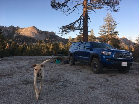
Camp looking across to the Big Sleep area.
On our second day, we set our sites on the Moto Wall area. The guide book was published in 2013 and mentions that the approach starts as a motorcycle trail that heads up to the Lookout Tower, but this has since closed to motorized traffic. There is a sign with various Forest Service information posters, but no trail name.
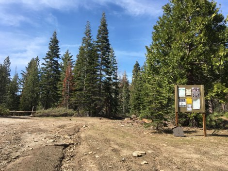
Park here and start you hike to Moto Wall.
The hike takes about 35 minutes with 800 feet of elevation gain. Near Moto Wall, the trail leads out to a slab that opens up to the south with a great view. The base is protected by a seemingly impenetrable wall of brush, but there is a way through. There’s a large bolder at the center of the wall, that’s where you’ll find a path.
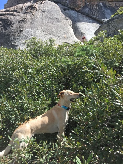
Aspen likes climbing around in the brush, but this is ridiculous!
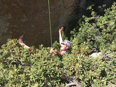
This brings us back to the subluxation of my shoulder. After it happened, I’ll be honest, I hung there and had a good cry for a few seconds. Then I took a deep breath to get my shit together enough to yell up to Route that I wouldn’t be able to climb. It’s my job to collect the gear that he placed on his way up. In order for him to collect the gear, he first had to set a rappel and make his way to the anchor on Blood of the Rose since our rope wasn’t long enough to rappel from the top. Then set another rappel, all the while collecting our gear. In the meantime, I hid in my sliver of shade.
I was betrayed by my good shoulder. I had subluxed my left shoulder back in September playing ultimate frisbee and knew it may try something again. But righty…you and me…we were solid, I thought we were in this together.
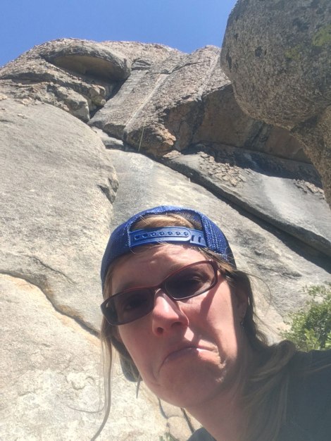
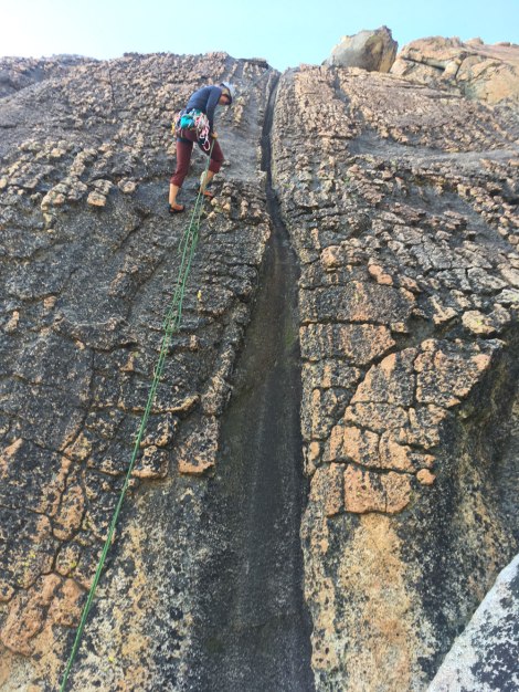
Hot Streak – two stars 5.8 and current mood.
With everyone back on the ground, we decided Route should try at least one more climb since we’d hiked all the way up to Moto Wall. He tested the limits of his outdoor climbing on Powerband and made it to the anchor.
After a snack on the slab, we hiked back towards the trailhead and our drive home.
Powerband – two stars 5.11a
I recently started physical therapy for my shoulders to strengthen their loosey-goosey ways and hope to visit Shuteye Ridge again soon. We visited Memorial Day weekend, when a lot of roads were still closed due to winter damage or snow presence. Even then, there was a decent amount to explore and more walls should be accesible now that it’s later in the season. Maybe we’ll see you again in the fall…
Looking forward to our next trip.
Happy,
Trails

I have been by Chiquito Ridge area so many times and I have always wondered about it but never stopped. I always seem to be on my way to somewhere else. It looks awesome though and worth exploring. Thanks for posting
Pingback: Find Your Lupine Field | Trails' Guide·