
Part of the fun of a road trip is pouring over a map to decide where to explore. Route’s sister’s wedding this summer in Colorado was the perfect excuse for a road trip. With a loose plan, climbing gear, and our backpacks we loaded the truck and crossed the deserts (not so) bare destined for the Centennial State. Here are a few highlights to consider from our travels from California to Colorado and back.
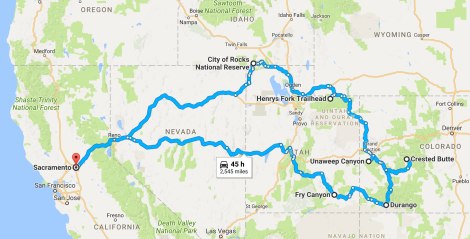
Road trip map from Google.
Southern Utah – Between my recent return from Europe and a bachelor party Route was attending, we had 29 hours to get from Sacramento to Durango. That left little time for sleep and even less for adventure. We chose a route through southern Utah so we could ogle the geology as we sped by. As night approached, we were nearing State Route 95. The surrounding cliffs and vistas faded away, but even in the darkness there were hints of the sheer volume of rock and earth towering over the road. Near Fry Canyon, we found a campsite away from the highway, took Aspen for a quick walk under a sky filled with so many stars that it was hard to pick out the constellations, and then crashed in the back of the truck. As the sun beamed into the windows the next morning, sandstone walls greeted us to the south and a deep canyon to the north. Even though we didn’t get to explore the area’s wonders, what a view to wake up to.
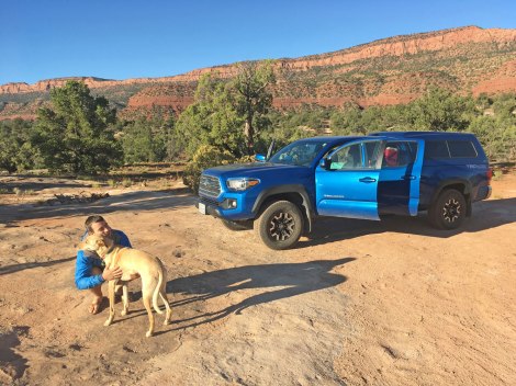
Good morning, Utah!
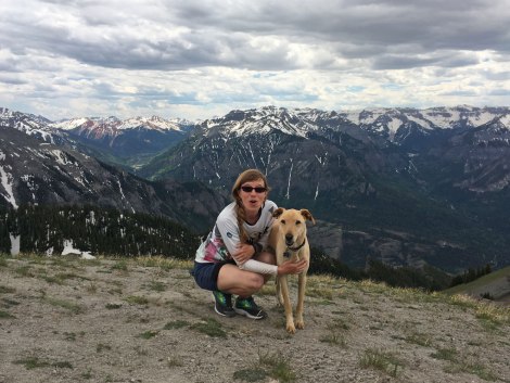
Weminuche Wilderness – We made it to Durango with less than five minutes to spare. Route was off to party on a house boat with the guys, leaving Aspen and I to entertain ourselves in the Colorado Rockies. I had grand plans of exploring Highland Mary Lakes or trekking to Chicago Basin, but spring run off and snow levels weren’t having it. We opted for a day-hike out of Andrew’s Lake with the bride-to-be. Colorado knows how to get high, with a lot of trailheads starting above 10,000 feet, so I appreciated the day to acclimate before our over-nighter.
Based on a suggestion from the local Forest Service, we headed to Cave Basin Trail. The starting elevation above Vallecito Lake was 10,800 feet. Once on the trail I realized why I saw oxygen bottles on convenience store shelves… The beginning of the trail was a lot of over the creek and through the forest, but I appreciated the shade. Once we made it to the limestone benches, the views opened up in all directions – Southern Needle Mountains to the west and mountains beyond mountains to the east. At that point, the trail played hide and seek with us as we made our way across sun-cupped snow fields, but as long as we kept the Needle Mountains to the west I wasn’t worried about losing our way.
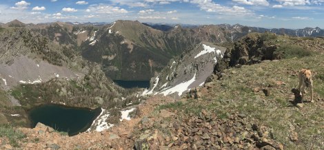
Dollar Lake overlook.
We climbed along the eastern slope until we stood on the ridge directly above Dollar Lake and gaped at the view. Not too shabby for a last-minute plan! We headed back toward the gargantuan cairn that marked the end of the well-defined trail and set up camp with a view of the Needles.
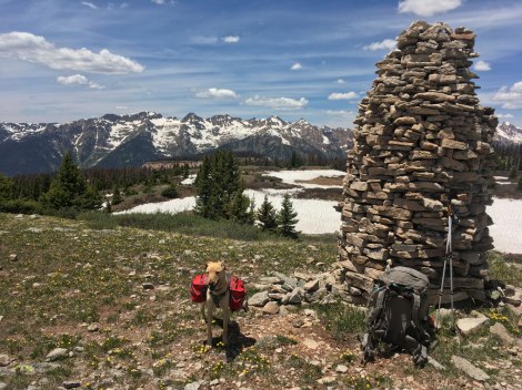
A bit excessive, but still impressive.
Million Dollar Highway – There is adventure around every hair-raising turn on Colorado’s Million Dollar Highway. Due to snow levels, we focused our adventures around Ouray. We hiked to Bridge of Heaven from the Horsethief Trailhead. the truck’s high-clearance was necessary for a creek crossing, but if you don’t have the clearance, start your hike from town or park before crossing the creek. The route we took was 6.6 miles out-and-back. We switchbacked through an aspen stand until we popped out at an overlook where the trail from town meets up with the main trail. From there the trail continued steadily up until the final switchbacks to Bridge of Heaven. The 360 degree view is impressive and worth the quad-burning ascent.
If you can time it right, I suggest packing some fresh-made bread from the Artisan Bakery in Ouray. The fresh bread comes out late morning (unfortunately I didn’t write down the exact time, but want to say it is either 10 or 11am). Post-hike, enjoy local brews with rooftop views at Ouray Brewery.
Oh my, look at the view from Bridge of Heaven!
A few times during our stay in Ouray, we had an hour or two to kill, not enough to go anywhere, but certainly enough to tackle a few climbs at the Rotary Park crag. It is just north of town. This wall is so convenient you could belay from your car if you really wanted to.
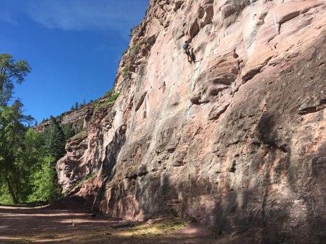
Rotary Park
Hartman Rocks – This was just a quick stop to camp, but was a drool-worthy trail system. Trail running, mountain biking, dirt biking, horseback riding, snow sports, camping, and more – Colorado’s Hartman Rocks has it all! In my mind all of these user groups gather here and sing Kumbaya. I’m sure it’s not that simple, but based on our one night spent here this is an absolute Bureau of Land Management gem.
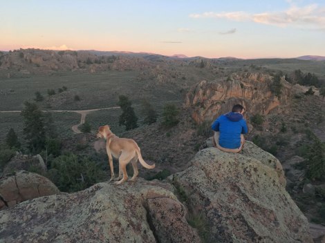
Looking down from their granite tower.
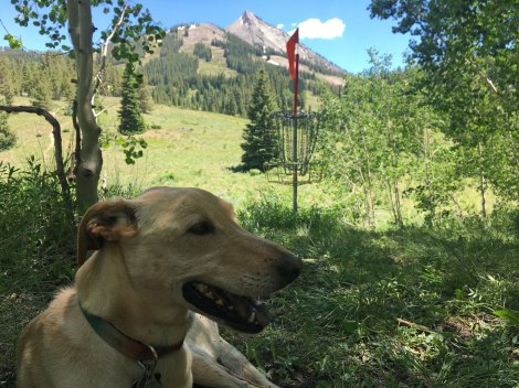
Crested Butte – The beauty of only having one reservation was we could follow our whims and adjust for the slowly melting snow. Our original plan was to head to the Wind River Range, but when we heard we’d need skis to get into the Cirque of Towers we revisited the map. So we delved deeper into Colorado; Crested Butte was intriguing and we’re so glad we found our way there. The landscape is beautiful, the town is inviting, and bikes are everywhere!
Unfortunately, we hadn’t brought our bikes, but we had packed our golf discs! Crested Butte Mountain Resort hosts the most scenic disc golf course in Colorado. With the Rocky Mountains stretching the length of the state, that’s a bold statement, but one that I would argue is true. The Red Lady Express Lift drops you off within throwing distance of the first tee. However, since Aspen was with us, we hiked our way up, avoiding the many downhill mountain bikers. Once at the top, the course guided us back down to the bottom with views of mountains beyond mountains the whole way. We did however, lose one green disc to an aspen grove on hole 16. It’s a ground score for someone in the future. May I suggest using discs any color but green!
A delightful rest in the shade after hole 12.
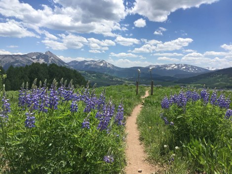
Route couldn’t reasonably leave Crested Butte without peddling up a mountain, but I was a bit intimidated by the best options. So while Aspen and I frolicked among the fields of lupine on the Brush Creek Trail, Route took to the mountains on the Deer Creek Trail for an epic ride! When we joined back up in town he was pumped on life and couldn’t wait to show me the photos of views on views on views. Side note: check out Travel Crested Butte’s amazing hiking guide!
Non-stop views along the Deer Creek Trail.
Henry’s Fork Trail – We found the second part of plan B among Utah’s Top 10 Backpacking Trips. We didn’t have time to summit Utah’s highest point – Kings Peak, but we had time to explore its flanks. The start of the hike was a bit of a forest slog, but once we got to the junction for Dollar and Bear Lakes it got better. We continued straight and skirted the edge of a meadow ringed with peaks. It sounded like most folks making a bid for Kings Peak camp at Dollar Lake, but we didn’t see its appeal. Among the trees at the lake we spotted a dozen tents without even leaving the trail. As we contemplated our next move, a cloud of misquotes descended on us, so we kept hiking. At the next trail junction, we headed toward Henry’s Fork Lake and found a secluded spot near an old cabin. I’m pretty sure we had that whole area of the basin to ourselves while everyone else crowded around Dollar Lake.
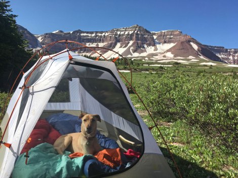
Camping in the High Uintas Wilderness.
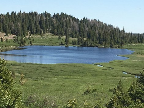
We took the trail via Bear Lake out the next day and didn’t see another person during that stretch. However, we did see a massive mammal of some sort from across a smaller lake. Maybe a moose, maybe Sasquatch – the zoom on my iPhone was not sufficient and I wasn’t about to go investigate. This trail wasn’t the most scenic we’ve been on, but between creek crossings in our skivvies and the wildlife sighting, it sure was memorable.
Mystery wildlife sighting.
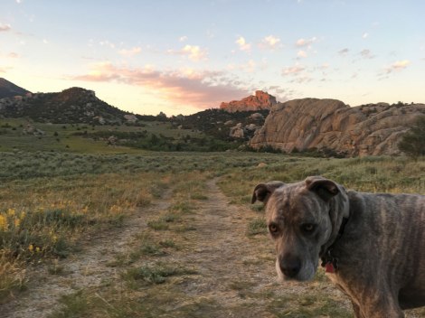
City of Rocks – The road trip grand finale was a climber’s paradise in south-central Idaho on Fourth of July weekend. In April, I realized the only portion of our trip in an established campground was going to be on a holiday weekend, but since it was in such a remote area I thought we’d still have the pick of sites. Ha – the good sites were going fast! Suppressing a minor panic attack, we frantically bounced back and forth between the reservation site and the campground brochure comparing what was open, dog-friendly, and had a decent shade grade. We booked a site and crossed our fingers it would work for Squirrel and family for their first camping trip with a six-month old.
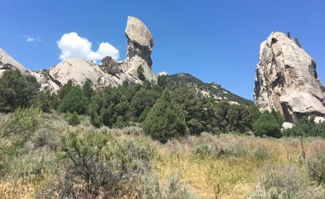
The whole City of Rocks experience turned out fantastic. There were hikes for Squirrel’s family and easy access to climbs for Route and me. It was a quick walk to Bread Loaves from our camp and we took advantage of it. In the morning we’d take a jaunt over for a climb and retreat back to our shady camp once it got too hot. In the evening we’d be back at Bread Loaves for a few more climbs. With adventure at our finger tips we could let the day unfold naturally and enjoy the good company.
View of the Bread Loaves from our campsite – Ella was less impressed than we were.
That is, until we left Aspen in Squirrel’s very capable hands to speed hike into a more remote section of the park to climb a spire. The clock was ticking to beat the heat of the day. Lost Arrow was a two pitch 5.7 and while I have done multi-pitch before, this was my first spire. The exposure was unreal. During the previous day’s single-pitch climbs, I watched sparrows soaring near the cliffs. While sitting at the second belay station on Lost Arrow, I was looking down at the sparrows. Their backs were a vivid green! The descent was a hanging rappel and swinging off the edge was the most awkward, suspenseful climbing maneuver I’ve managed to date. You’ve gotta try it!
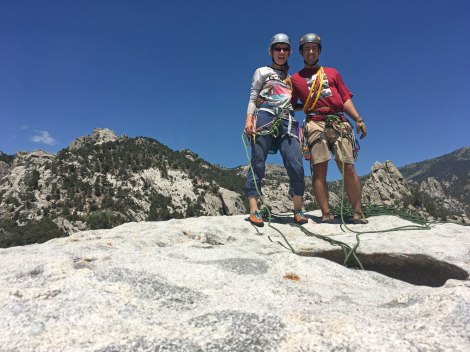
Enjoying the view from the top of Lost Arrow.
That little white speck on the tip of the arrow is me!
The copy of City of Rocks and Castle Rocks State Park by Dave Bingham we bought at the visitor center was the best resource we picked up during our entire road trip. This guidebook is a wealth of knowledge, mostly for climbing, but it also has hikes, family activities, and general information. The route descriptions are on point, the photos are quality, and maps take you from A to B clearly. If you’re climbing in the area, I highly recommend getting your hands on a copy.
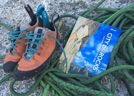
Pick up a copy of this guidebook at the visitor center!
We certainly haven’t been everywhere, but racked up six states, 17 nights camping, more than 2,545 miles logged, one wedding, loads of tail wags, and countless memories. Those included above were just a few!
Where to next?
Trails

Sounds like a lot of fun for a short road trip! …gotta love ’em!
Dogs are the best
There has never been a truer statement. 😀
Pingback: Find Your Lupine Field | Trails' Guide·