
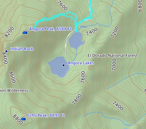
Destination: Angora Peak
Mileage: 2.5-ish round trip
Trailhead: Angora Lakes parking area at the end of Angora Ridge Rd./Forest Service Rd 12N14
Elevation: 7,270 up to potentially 8,588 feet
Aspen and I were pouring over a Tahoe map trying to decide on a hike. Something on the south shore, nothing too lengthy, and water wasn’t looking appealing. My adventure pup is land-based and apparently I have become a wuss and won’t jump in cold water unless Route is there to give me a literal nudge of encouragement. Alright, a high point so we can look out on the big blue waters of Tahoe. Ralston could still have snow and we’ve already been up Flagpole Peak and Mount Tallac. That’s when I stumbled upon Angora Peak. Based on the map, it was a short hike with potential for big rewards. Based on the hike, I’d say it was a success!
Coming from Highway 50, I originally overshot my turn for Angora Ridge and ended up driving along Fallen Leaf Lake. Nothing was set in stone for this hike so I thought, maybe we’ll just hike from the end of the road at Fallen Leaf. While the lake is pretty, I’d venture to say this place is the Disneyland of Tahoe. People everywhere! We quickly retreated and brought up Google Maps to find Angora Ridge Road. Following the map, we discovered the (currently) un-signed road and meandered through an aspen grove; now we’re talking.

The turn for Angora Ridge Road/Forest Service Road 12N14 – either way, I didn’t see a sign.
There’s a large parking area, which costs $7/day. Personally, I’m happy to give funds to the dog-friendly Forest Service, so I put money in the drop box and we headed up the trail/road toward Angora Lakes. There are cabins and a resort, which isn’t my usual crowd, but we weren’t around the crowds for long.
We made a quick stop at the first Angora Lake for a snack and some water before a short backtrack toward the eastern flank of Angora Peak.

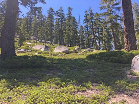
The first Angora Lake.
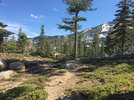
The base of the climb looked like a manzanita-fest and my first thought was, why do I always forget to wear pants on cross-country adventures?! Thankfully is was all low-growing foliage and I hiked away with only one sizable cut. We headed north until just before the topography started descending and then turned west to climb.
The start of the climb.
My strategy for climbing was to switch back from one shady spot to the next, while Aspen’s was to find all of the snow patches.
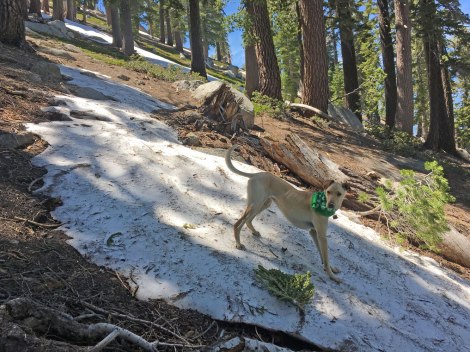
Aspen slid to a stop on this snow patch.
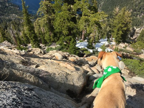
There were a few small snow fields with worrisome run outs near the top. I wish I had my trekking poles because all the sticks I found were decomposing.

Snow field near the top.
For the last 50 feet I had to leave Aspen leashed to my pack in the shade, it wasn’t even mountain-goat-dog friendly. However, come to find out, we still weren’t at the top! We were 88 feet in elevation shy and a few hundred yards north-east. I wasn’t looking forward to the snowfield descent already and the route to the actual peak was just more snow. The thought of continuing on didn’t even cross my mind.
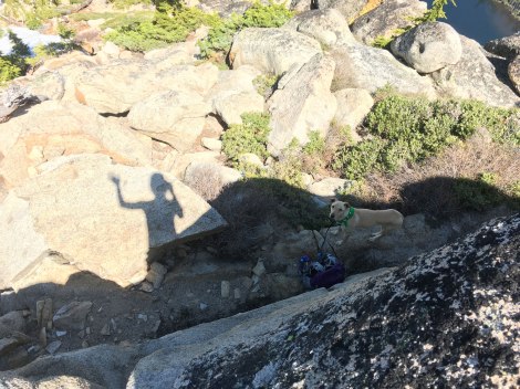
Scrambling up the last 50 feet.
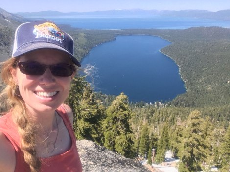
The Tahoe view from the “top.”
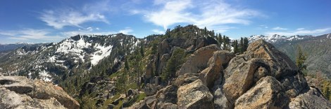
Echo Peak on the left and the true Angora Peak on the right.
As I enjoyed a break and a brew at the top with my granite backrest and Aspen dozing in a bush, I couldn’t help but look over at Mount Tallac and compare the two hikes. Tallac was all on trail, longer, and a horde of people at the top. Angora was cross-country, short, and just my adventure pup and me. The hike you pick depends on your goals, but I really enjoyed not having to share the “summit” with any other groups – it was our very own slice of Tahoe.

Harper Mountain Goat and the Angora Lakes basin.
The hike down was much faster than the hike up, but we still had to carefully pick our way around the snow fields and tactfully kick step our way through others.
Now how did we get up here??
Once the elevation mellowed out we turned south back to Angora Lakes for a quick water break.
The last stretch to Angora Lakes.
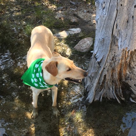
Cooling off her barking dogs (ha!).
If you opt for the solitude option, please remember that Angora Peak does not have a designated trail which means you need to be prepared for off-trail travel for your safety and the safety of the landscape. If you’re in a small group, spread out your impact as Leave No Trace suggests. If you’re in a large group, stick to a peak with a designated trail.
Click for larger map.
Happy,
Trails

I love seeing pictures of happy hiking dogs!
Pingback: 2016 Blooper Reel | Trails' Guide·