
I thought Oregon was all trees, but that’s just what they tell Californians who have been spoiled by Sierra Nevada views to keep them away. However, the towering volcanoes lined up in both directions with lava rock and obsidian crunching beneath our boots told a different story. A story of Mother Nature’s devastating, yet wondrous force.
Destination: Three Sisters stretch of the Pacific Crest Trail
Mileage: 39.8
Trailhead: McKenzie Pass PCT off Hwy 242
Elevation: 4,800 up to 6,750 feet
Rumor has it the Three Sisters Loop is some of the best backpacking in Oregon. However, for various reasons we decided to do a stretch of the Pacific Crest Trail (PCT) along the Three Sisters and south instead. Looking back, we should have ignored those reasons and done the loop; I fell in love with the Sisters and the rest of the trip was filled with the mosquito cesspools that Oregon calls lakes.
After dropping our vehicles off at Lucky Lake Trailhead, we were shuttled to McKenzie Pass PCT Trailhead. Fun fact, there’s actually three access points to the PCT on McKenzie Pass Highway within about a mile of each other. We made this realization after our ride left and we wandered through the woods for a bit… Turns out we were at the trailhead farthest from the night’s destination and the sun was hanging low in the sky. Time to kick it into high gear to make the 3.7 miles to camp.
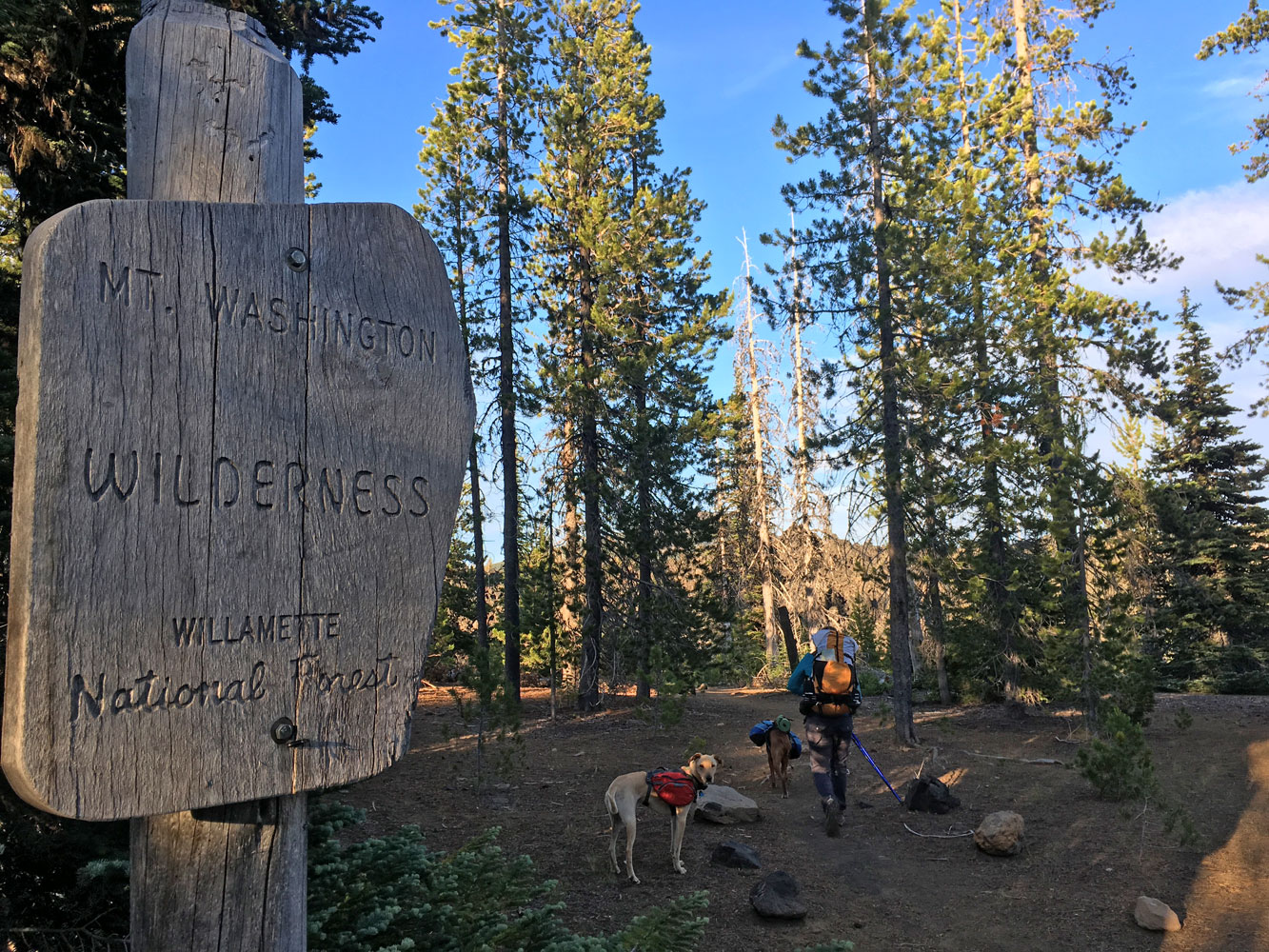
Another wilderness added to my list!
Due to the mix up in trailheads I actually added Mount Washington Wilderness to my list and hiked through a lava flow – lifer! We crossed McKenzie Pass Highway and passed the Lava Camp Trail junction, which is where we were originally planning on joining the trail. As we hiked the final miles to South Matthieu Lake, the sunset painted the sky with oranges and silhouetted the Cascade Range.
The confusion continued as we entered the South Matthieu Lake Area, where you’re only supposed to camp in one of the three designated areas. Maybe it would be easier during the day, but we could not find the post marking the campsite on the east side of the lake. Headlamps from across the lake indicated we weren’t the only backpackers, but we didn’t think they wanted company at the late hour. So we found a clearly well established site and figured the post hadn’t survived the winter.
In my research before the trip, everyone said bear canisters were overkill in this area and recommended hanging scented items. Well with my scented items bagged and rope in hand, there were no suitable trees to hang food. Sure we were looking in the dark, but a canister would have greatly simplified things. So after throwing rocks and yelling at a pair of eyes watching us from the woods, we just slept with food in the tent, hoping the scent of two dogs would deter any wildlife. No wonder I had dreams about a zombie hiker lurking outside my tent…
Sidenote: Turns out the post was nowhere to be found during the day either. Looking at the map online, the site may have been more at the north end, but in the dark of night, I could swear there was supposed to be one on the east side.

Good morning South Matthieu Lake!
On the second day we hiked the length of all three Sisters; I was amazed the entire way. This volcanic landscape was unlike anything I’d ever hiked before and I absolutely LOVE the volcanoes beyond volcanoes.
The meadow at the Scott Trail junction had a great view of North Sister and Little Brother. And don’t forget to look north while climbing to Opie Dilldock Pass for a lengthy view of the Cascades.
Volcanoes beyond volcanoes beyond Aspen.

All of the switchbacks off of Opie Dilldock Pass.
This stretch also took us through the Obsidian Limited Entry Area; obsidian is right! We could fight off a serious amount of White Walkers with the mounds of dragon glass here. We didn’t need a special permit to pass through the area, but if you’re camping in the area or starting your hike here, you’ll need one.

All of the dragon glass.

Spring conditions in July.
The creek leading up to the top of Obsidian Falls was a great spot for a water-front lunch break.

Passing Obsidian Falls.
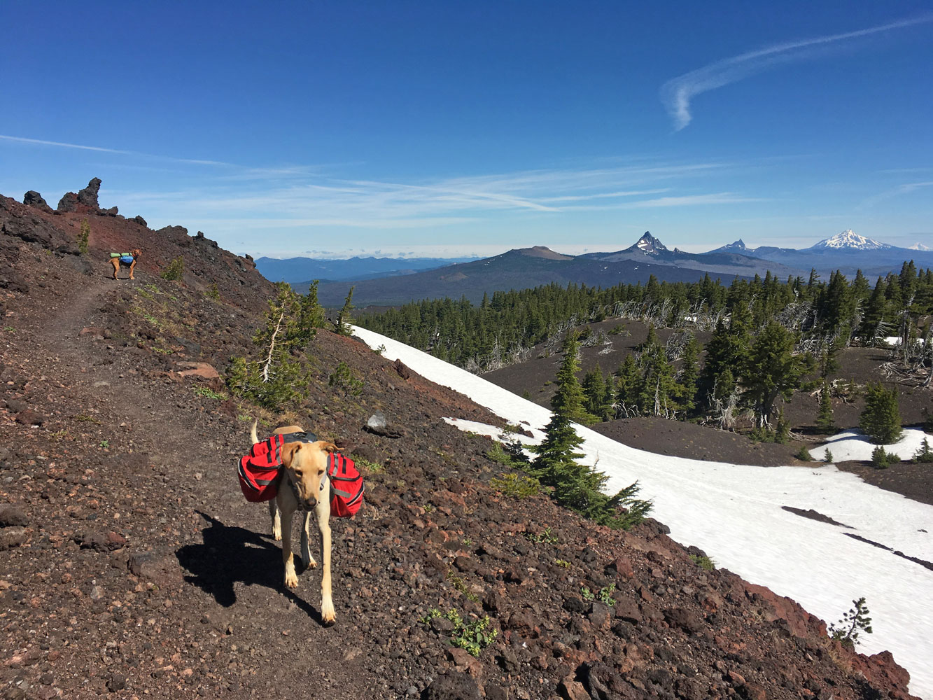
This stretch of trail had tons of volcano views, obsidian, and also snow fields. More than expected in July, but that’s what happens when we finally have a winter!

Snow fields below Middle Sister.
I really enjoyed the variety of scenery in this stretch. We’d hike through pine trees, then down through a meadow with volcanic views, then back up into the pine trees for some shade. Shortly after we passed Middle Sister to the east, we passed The Husband to the west.
This meadow had an amazing view of South Sister – promise.
Traveling the length of the Three Sisters put us in at 15.8 miles where we camped at the edge of Mesa Creek meadow. This is where we got the first real taste of Oregon mosquitoes. We picked a campsite and I threw up the tent so poor defenseless Aspen could jump inside.
The original plan was to hike all the way to Sisters Mirror Lake, but it was getting late in the day and we weren’t sure what lay ahead on the Wickiup Plain, plus my arches had already been aching for the last few miles.
After dinner our food was bagged up again and ready, with no good tree insight. To be honest, we could have searched more, but we told ourselves the dogs would keep the bears away. That night both Yoshi and I slept terribly! I lay there thinking, sure I have my pots and pans to make noise with, but what if the bear doesn’t care? What then?!

Hiding from mosquitoes at Mesa Creek meadow.
The next morning Yoshi told me she was having flashbacks to horror stories she heard at the carnivore conference she recently attended. We both agreed to hang our food that night, no matter what the trees looked like.
We were both moving slow that morning due to the restless night, which was fine since everything was covered in condensation. We laid our tents out to dry and waited for the sun; when it finally peaked over South Sister’s flanks, the mosquitoes came out too. Fantastic… As soon as everything was at least mostly dry, things were shoved in packs and we hiked on and up to Wickiup Plain, which was delightfully mosquito-free. Along that stretch of trail, we also passed The Wife, completing the family.
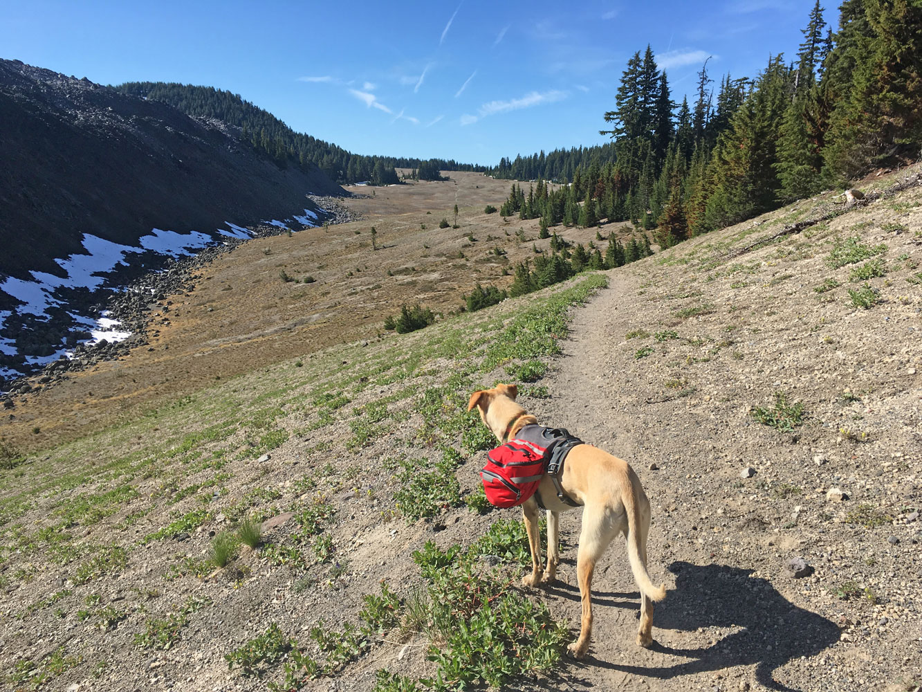
Looking across the Wickiup Plain.
At this point we should have taken the La Conte Crater Trail and worked our way to Green Lakes to do the Three Sisters Loop. To the south we only found trees and mosquito cesspools, I mean lakes, which didn’t even look that tantalizing to jump in. I’m being negative because my feet were still throbbing as I made this note the day after we got off the trail. I’ll admit some of the lakes were pretty, but paled in comparison to the trail along the base of the Three Sisters.

Aspen at Sisters Mirror Lake.
Hindsight is 20/20, so we continued into the mosquito clouds; we stopped at Sisters Mirror Lake briefly for a snack. From there we deviated from the PCT to cut out some miles and elevation. At this point my arches were already starting to ache again so I was all for the shortcut. However, the Red Hill Trial isn’t highly traveled so the mosquitoes there were even more ferocious since human flesh is a rare treat.
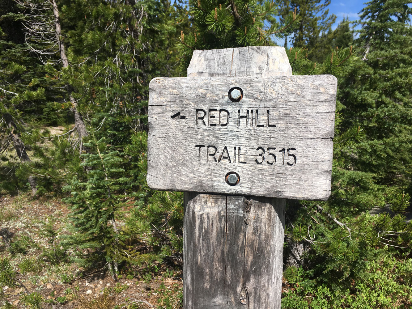
Right turn at Red Hill Trail.
We made some serious mileage on the mellow topography trying to out pace the buzzing cloud. Each trail junction came up quicker than expected. We weaved our way through staying on the Red Hill Trail, which popped us back out on the PCT. It was at this point that I started imagining a netted trail that would be a respite from all the bites I was accumulating.

Rare truffula pine tree.

How is this trail marker still standing?!
The pain in my arches was building as we tacked on the miles, but we couldn’t stop to rest, lest we get mauled by the buzzing cloud – I discovered my Sisyphean task for the Underworld. With each step I came to the realization that the last leg of my Oregon adventure, a loop around Broken Top Mountain, was not realistic in my condition. However, Squirrel and Basil were leaving the next morning to meet me in Bend so I had to let them know our backcountry adventure was adapting to front country. This meant hiking all the way out that day and more miles on my feet, but with a silver lining of an escape from the bites and no need to find this mythical tree to hang our food bags.

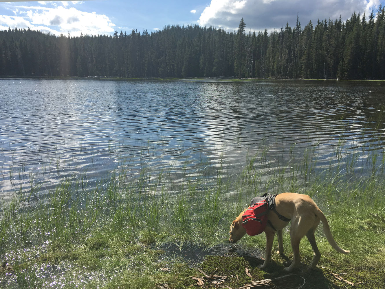
Filtering water and fighting off mosquitoes…
We made a quick stop at Dumbbell Lake to filter water, then continued on to find the Six Lakes Trail junction. By this point, pain was shooting down my toes on my left foot and shooting up my ankle on my right foot. So when we reached the junction I proposed a plan to take a shot at every trail junction of the terrible whipped cream vodka Yoshi had packed in. In her defense, she thought it was regular vodka when she bought it and every backpacker knows that food and drink tastes better in the backcountry, so what better place to get rid of it. Either way, for the mile after that first shot my feet felt like themselves again. Too bad it was almost two miles until the next junction…

Woman down…
At the junction for Senoj Lake I had to stop and try something, anything… so I taped my feet and took another shot. The tape helped until we started to descend after Williamson Mountain and then it felt like my feet were trying to squeeze out the front of the tape and slowly cut off the circulation to my toes.
Aspen at Senoj Lake.
Once we reached Lucky Lake, we could tell we were in front country based on a discarded flip flop here and a beer can there. Not that much trash, but enough to say, “I don’t think we’re in the backcountry anymore, Aspen.” I limped through a little happy dance and prepared for the final descent to the trailhead.

Aspen and Deke at Lucky Lake.
The final day on the trail ended up being 20.3 miles, which may be my longest day backpacking yet; dinner and beer at Deschutes Brewery was well earned to say the least.
I would backpack here again in a heartbeat, you know, once my feet are fixed. However, I would hike the Three Sisters Loop starting at Lava Camp Lake and hike clockwise, saving the western slopes for last to end on a fantastic note.
Have any of you hiked this area? Thoughts on the Three Sisters? Horror stories about mosquitoes?
Happy,
Trails

The Three Sisters are certainly my favorite part of the Oregon Cascades. The awesome geology and number of great peaks make for excellent scenery and a sense of expansiveness found anywhere else in that part of the state. Of course, if you don’t know of it already, the Eagle Cap Wilderness in the Wallowas is one of Oregon’s best kept secrets. It is utterly spectacular. The Strawberry Mountains are worth checking out too!
http://www.summitpost.org/wallowa-mountains/171205
Thanks for the insight BubbaSuess, I’m intrigued!
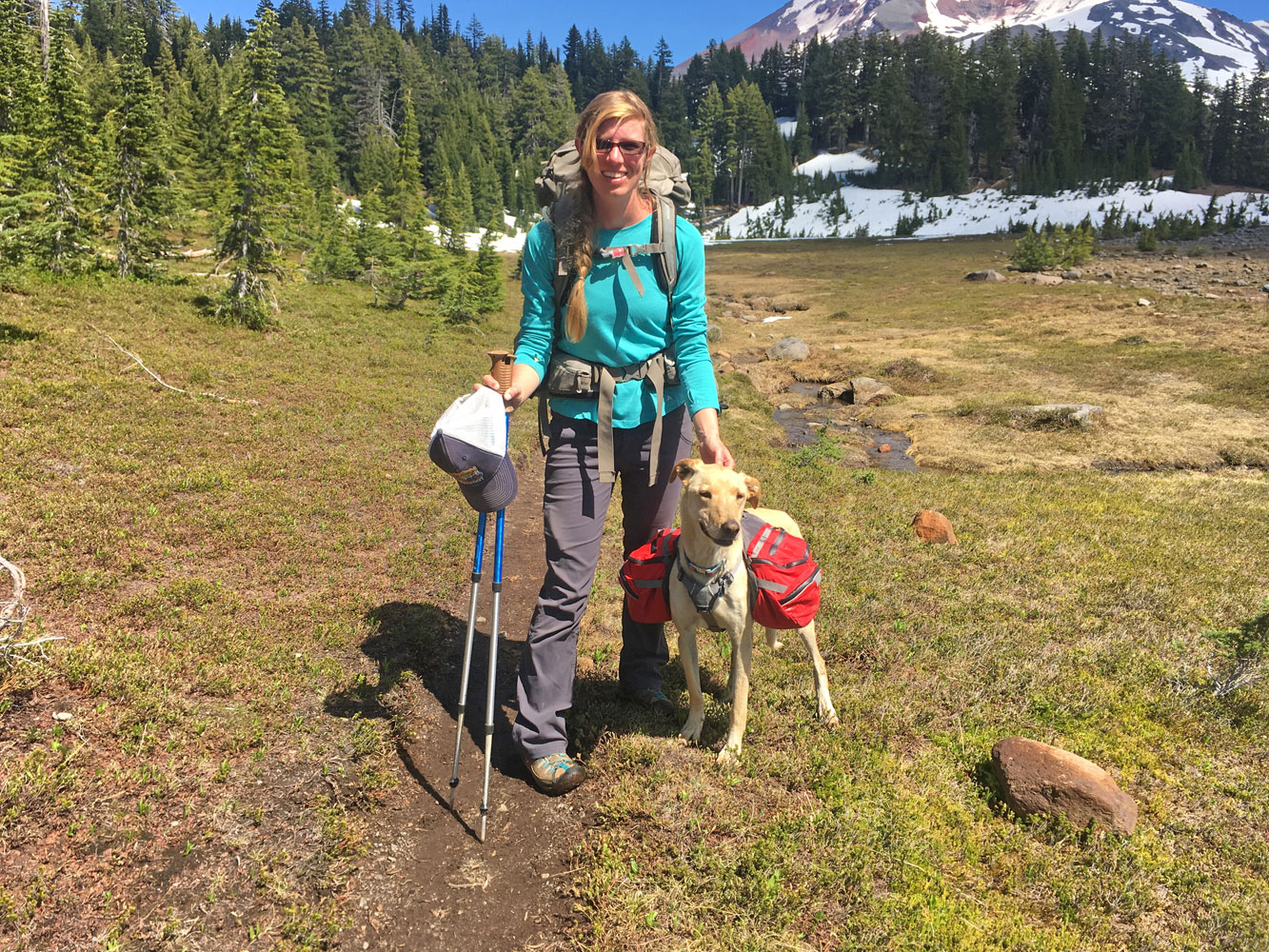
Looks gorgeous there. Oregon is on my list of places either this year or next (hopefully). What kind of pack does Aspen carry? It looks like it has much more space than the one I have for Piper.
Hi AdventureDawgs!
Aspen used to hike with an REI pack, which they don’t make anymore. I was tired of clipping extra things to the outside, which sounds like you’re dealing with the same issue. She now has a Ruffwear Palisades pack, which has a ton of space, two water bladders, and my favorite feature – the detachable saddle bags, which is fantastic for breaks. Aspen is right on the edge between a small and medium, but I went with the small since I didn’t want the pack to be excessive for her. The small had just enough space for four days of food, treats, jacket, training collar, paw cream, leash, and sleeping bag (it was like a clown car in there!).
I will note, depending on where/what you’re doing in Oregon, you may want some paw protection too. Aspen has tough pads and made it along this trail unscathed, but when we hiked the Obsidian Flow in the Newberry Crater, I put her socks on. She can’t do boots cause her paw shape, but socks were sufficient for the short hike, I just use the sticky vet wrap to keep them on.
Have fun when you make it to Oregon, I look forward to seeing your adventures!
-Trails
I’ve got a Canine Equipment pack for Piper and the saddlebags are tiny. At least they detach as well but the fit just doesn’t seem right for her.
Socks are a great idea. We don’t have a lot of sharp rock here and while we’ve never had issues with ground yet, it’s good to be ready for it. Cheers
Pingback: Bendless Summer: Even More Adventure | Trails' Guide·