
Destination: Somewhere along Horsetail Falls
Mileage: Chose your own adventure
Trailhead: Pyramid Creek, off Hwy 50 near Twin Bridges, recreation fee $5
Elevation: 6,120 up to 7,520 feet
Driving west on Highway 50 from Tahoe as you descend into the American River Canyon there is a bend in the road around the canyon wall that reveals a sweeping view of Horsetail Falls and the side canyon it dominates. I’ve stopped at the trailhead a couple of times on the drive as a quick rest stop, but never made it farther than the flush toilets – that’s right, flush toilets at a trailhead! The initial idea was to go on a short hike, sit by the pool at the base of the waterfall, take some photos of Aspen for Instagram, and get a little work done. Then adventure happened.
I suppose my first clue this was not going to be a normal hike should have been when I tried to put my boot on and discovered a dead mouse (1). When I realized what my foot had touched I may have let out my girliest scream to date and thrown my boot across the parking lot. After disposing of the mouse and going to my happy place when I put my boot on, we were ready for a hike.

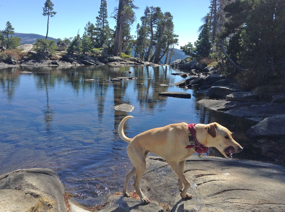
A fantastic swimming hole along the lower section of the trail.
At first the trail mirrored Pyramid Creek, when we got to the signed trail junction we kept following the creek along the Cascade Loop. After playing connect the dots with diamond hiker trail markers, we joined back up with the main trail, crossed the wilderness boundary, and found the trailhead kiosk where we picked up a day permit (2). Leaving the kiosk, the trail meandered through the woods a bit until it came to an end at a little bog (3).

Connect the trail marker dots.
I saw a rock pile up on the granite, so I headed for higher ground until it started getting a little sketchy for a solo hike (4). Aspen and I stopped to have a snack to assess our situation. In the meantime, a group of four guys and two dogs arrived at the same trail section. We watched them from our perch on the canyon wall waiting to see if they spotted a better trail. After some contemplation, they started hiking straight toward me. Once they scrambled to the shelf below me, I asked if they knew where they were going and if we could tag along. The group turned out to be a retired dad, his two sons, and an extra guy they picked up in the parking lot. We definitely had a mix of abilities and fitness levels, with the parking lot guy bringing up the rear.
We scrambled up higher passed an especially tricky section that did not look promising for a return trip. It was a little after this that I realized I never asked where they were actually going (5). Turns out while my goal was the base of the falls, their’s was 640 feet higher – the top of the falls. I didn’t feel safe retreating down the side of the canyon, so their goal became my goal.

Rock piles marking the route.
With a few of the trickier sections behind us the parking lot guy kept mentioning going back down, which was not a wise decision. We were one shelf from the ridge line when he decided he’d officially had enough. While I wasn’t expecting such a long day, I didn’t feel comfortable hiking off the mountain with this fellow (6)(7).
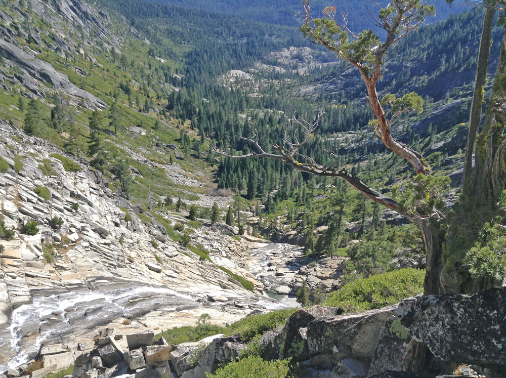
The rest of us ascended the last shelf and followed the ridge along relatively-mellow terrain and soon found ourselves at Avalanche Lake. The view of the water’s edge before spilling over the cliff was serene.
The view at Avalanche Lake toward the falls.
For the descent we decided to stick closer to the waterfall, a route one of the sons had traveled before. While this was a more direct route and didn’t take as long, there were definitely some sketchy sections (8) where even my mountain goat pup was a little unsure (9). By taking our time, sticking together, looking out for each other and the pups we made it down to the pool below the falls – my original destination. The rest of the trail was smooth sailing including the flooded section that I thought was a dead-end.
Watch that first step, it’s a doozy – the view from the top of Horsetail Falls.
On a side note, the previous night I read a blog about how wonderful hiking in a skirt is and that skorts defeated the purpose, which is what I’ve hiked in before. I decided I had to try out this hiking in a skirt with just underwear, I made that decision when I had my mellow hike in mind. Once I started scrambling up the canyon wall, I kept thinking to myself, this was not the day to try hiking in a skirt. I tried to remain discreet and keep my bright-orange Patagonia underwear under wraps, but I was scrambling up a canyon wall…with complete strangers…again, this was not the day to try hiking in a skirt (10).

Aspen and me at Avalanche Lake.
While I will happily hike to the base of the falls again, I am content to cross Avalanche Lake and the top of Horsetail Falls off of my to do list. Although I’m glad we made it to the top, the view from Highway 50 has a whole new meaning!
Thank you to Joel, Tyler, and Paris for letting me join their group. I may have found the trail to the base of the falls if I had gone back down, but I would not have had the same adventure.
For more information about the area, visit Sierra Nevada Geotourism. All the research I did about this trail included clear warnings: rocks can be slippery and the water is fast moving. From what I read, people who get too close to the falls get swept down stream, the lucky ones live to tell the terrifying tale. On that note, enjoy your hike!
Happy,
Trails
(1) Shake out your boots before you put them on, even if they came from the safety of your closet.
(2) Even if you fill out a day or overnight permit, it is still essential to tell an emergency contact your travel plans.
(3) Take a closer look at surroundings before setting off on a route, the bog was really just a flooded section of trail.
(4) Be more cautious of trail conditions when hiking alone.
(5) Be sure your travel plans match with other hikers before you join forces.
(6) I’m not saying I would have ended up chopped into little pieces for wildlife food, but I typically regret when I ignore the little voice in my head.
(7) I felt guilty letting parking lot guy go back down the mountain by himself, but he was in no condition to make it to the top and back down safely; so we guided him toward a safer route and asked what kind of car he drove so we could make sure it wasn’t still there when we returned to the trailhead.
(8) Help height-fearing friends through the tough sections, the type of help needed may vary with the friend.
(9) If your dog is not part mountain goat, I’d recommend making your destination the base of the falls.
(10) Other than that it was as amazing as promised – great airflow, comfortable, not restrictive, and discrete while using my Pibella.
