
Destination: Caribou Basin
Mileage: 16.2 miles round trip from trailhead to Sawtooth Ridge
Trailhead: Big Flat Trailhead off Hwy 3 north of Weaverville, CA
Elevation: 4,933 up to 8,105 feet
I first saw this hike in a Backpacker Magazine article and fell in love with the view looking north over Lower Caribou Lake. Trinity Alps Wilderness is still somewhat of a hidden gem, but when we pulled into the trailhead campground at 3 in the morning Saturday of Memorial Day weekend and our headlights swept across a handful of cars and two college vans from Oregon, I knew the word was out. At this point, I might as well share what makes this trip so amazing. 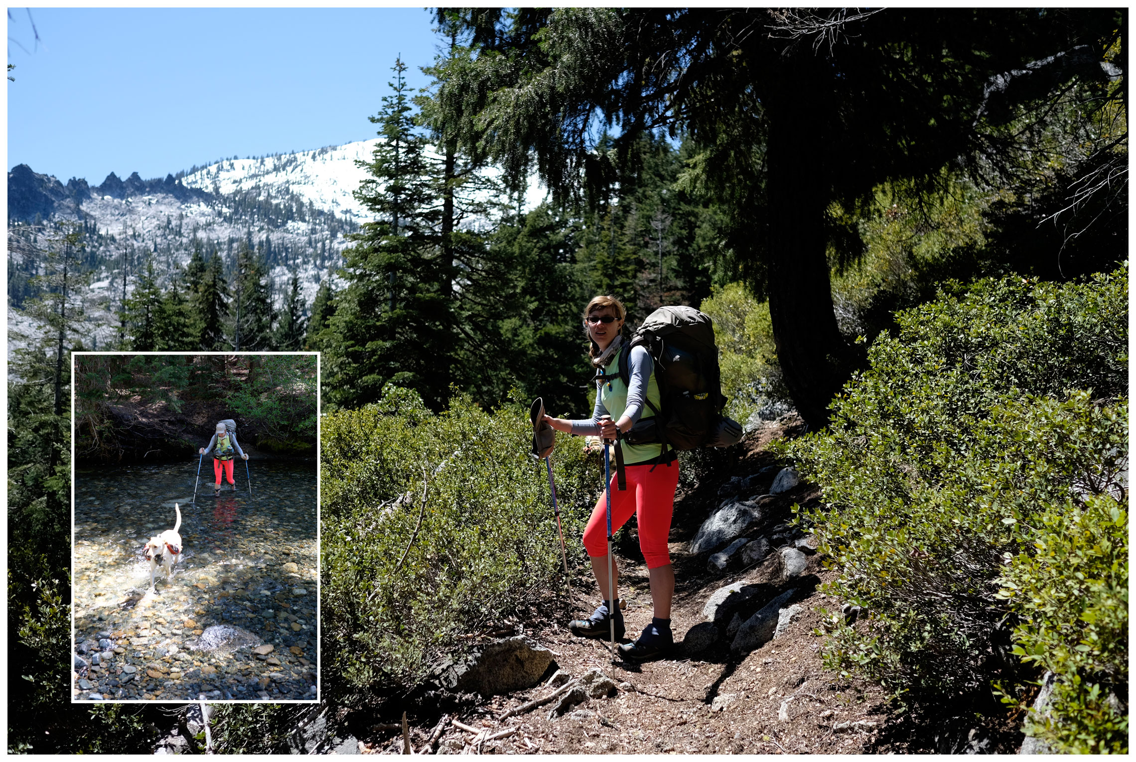 We camped overnight at Big Flat Campground/Trailhead. After divvying out group items and loading our packs we hit the trail. A short walk brought us to the only shoe-off creek crossing. I’d recommend walking the first quarter mile in your camp shoes and putting your boots on after. Just after the crossing the trail divides; the new trail continues straight while the old trail goes northwest along the creek. For the trip in we chose the new trail and started switch-backing up the mountain.
 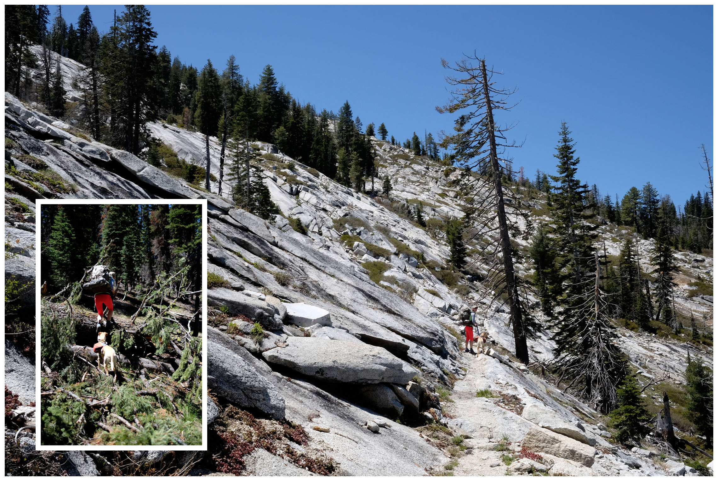 Once the trail reaches the saddle it intersects with the old trail. Continuing on the new trail, we crossed through granite slabs where spring creeks were rushing down the mountain-side. Be warned, throughout the whole trail there were quite a few downed trees, some easier to get around or over than others.
  After the slabs we traveled through an area that burned in 2008. I was telling Compass about The Charcoal Forest children’s book and how some wildlife thrive in burned areas when we heard a Black-backed Woodpecker. Well I didn’t actually get a visual, but it was some sort of bird pecking at a tree to get to the insecty-goodness inside. We wound around the mountain making our way to Browns Meadow and stopped there for a break and noticed a few nice campsites. From what I hear, it’s the only place to camp along the trial.
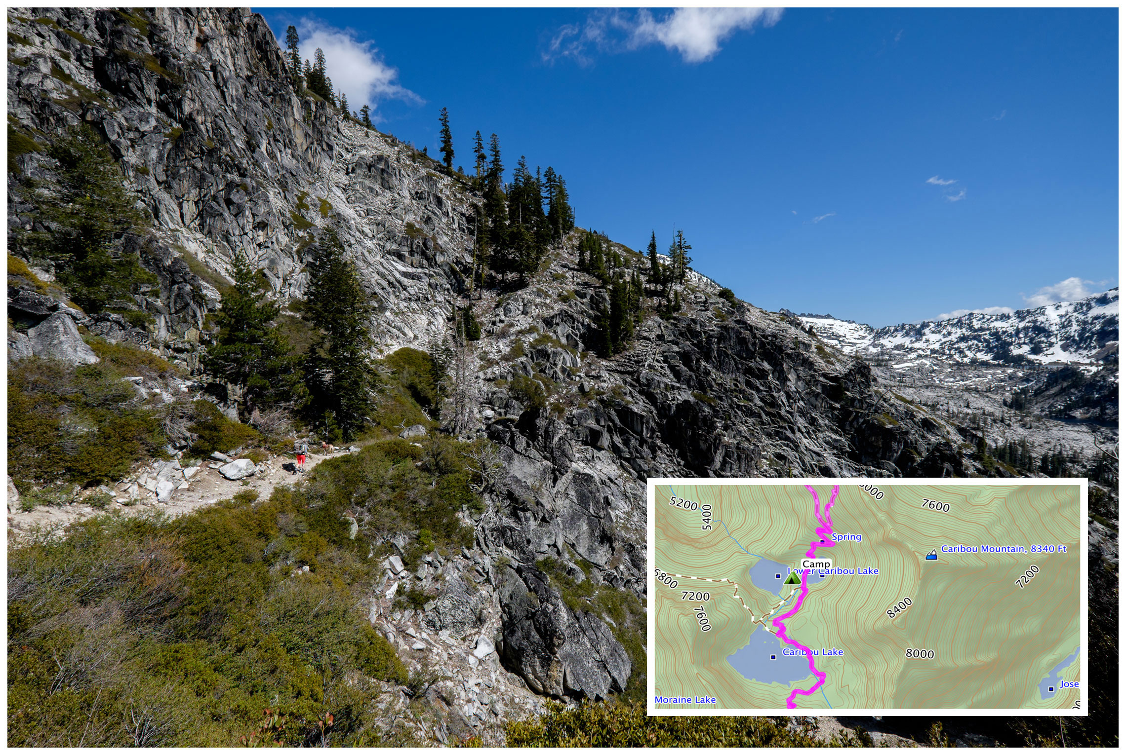 After climbing out of Browns Meadow the trail continues around the mountain and then opens up to views up the canyon to Caribou Basin – holy granite basin! The rest of the hike in is full of fantastic views until the final descending switch-backs to Snowslide and Lower Caribou Lakes. Click here for a PDF map of our route.
  We found a tent-sized rock slab for camp on the ridge between Snowslide and Lower Caribou Lakes. It was flat with an amazing view so I was ok with a breeze – it kept the bug away. However, our sweet view became a backpacker-filled amphitheater at sunset. It wasn’t the typical remote backcountry experience, but with that view, who can blame them?
 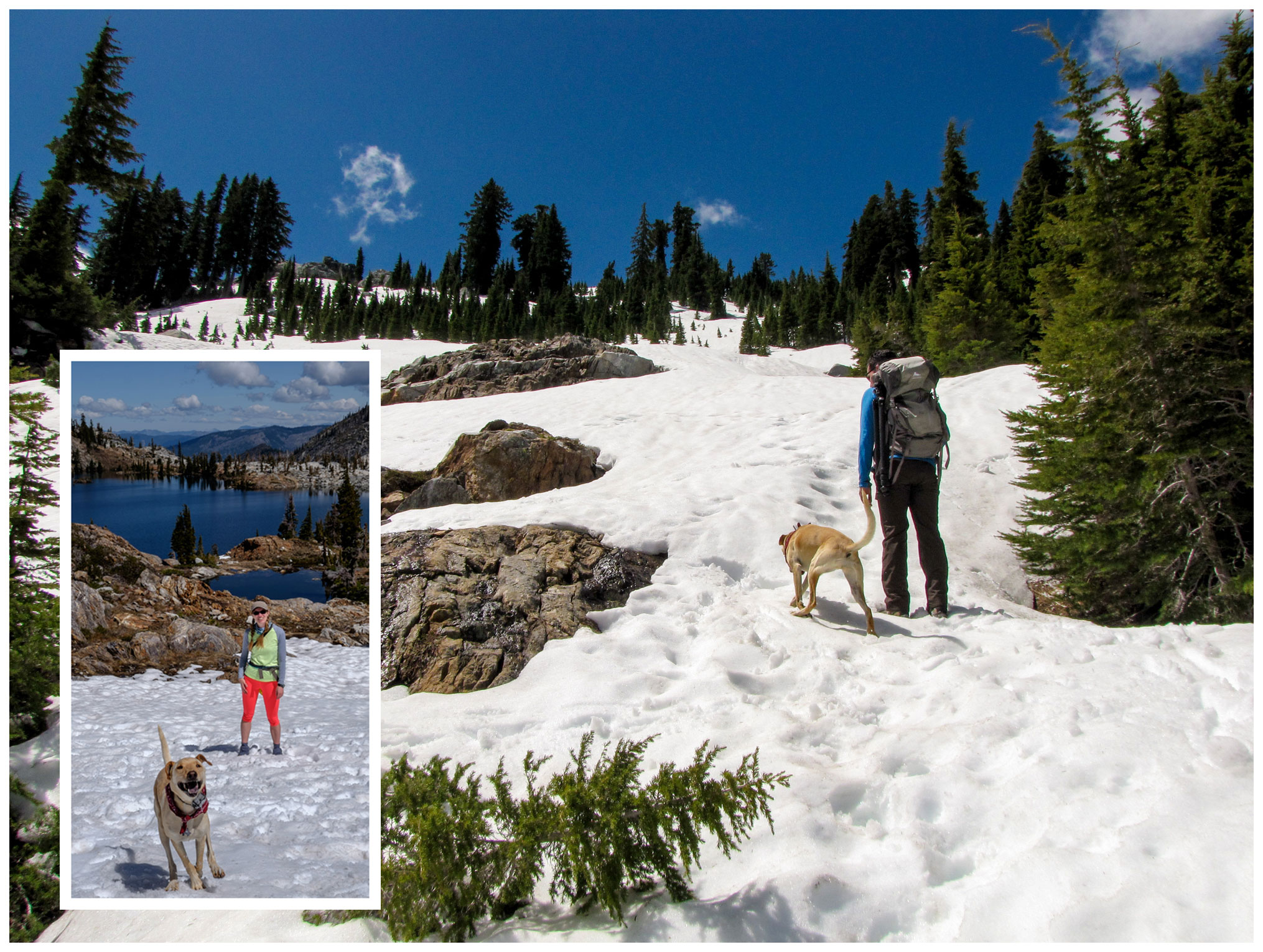 On our “down” day we hiked up to Sawtooth Ridge. Being early spring, we discovered the trail above Caribou Lake covered in snow. We figured why not give it a try and turn back if we feel unsafe. There were two other hikers making their way up too so we worked our way up together and made it to the top!
 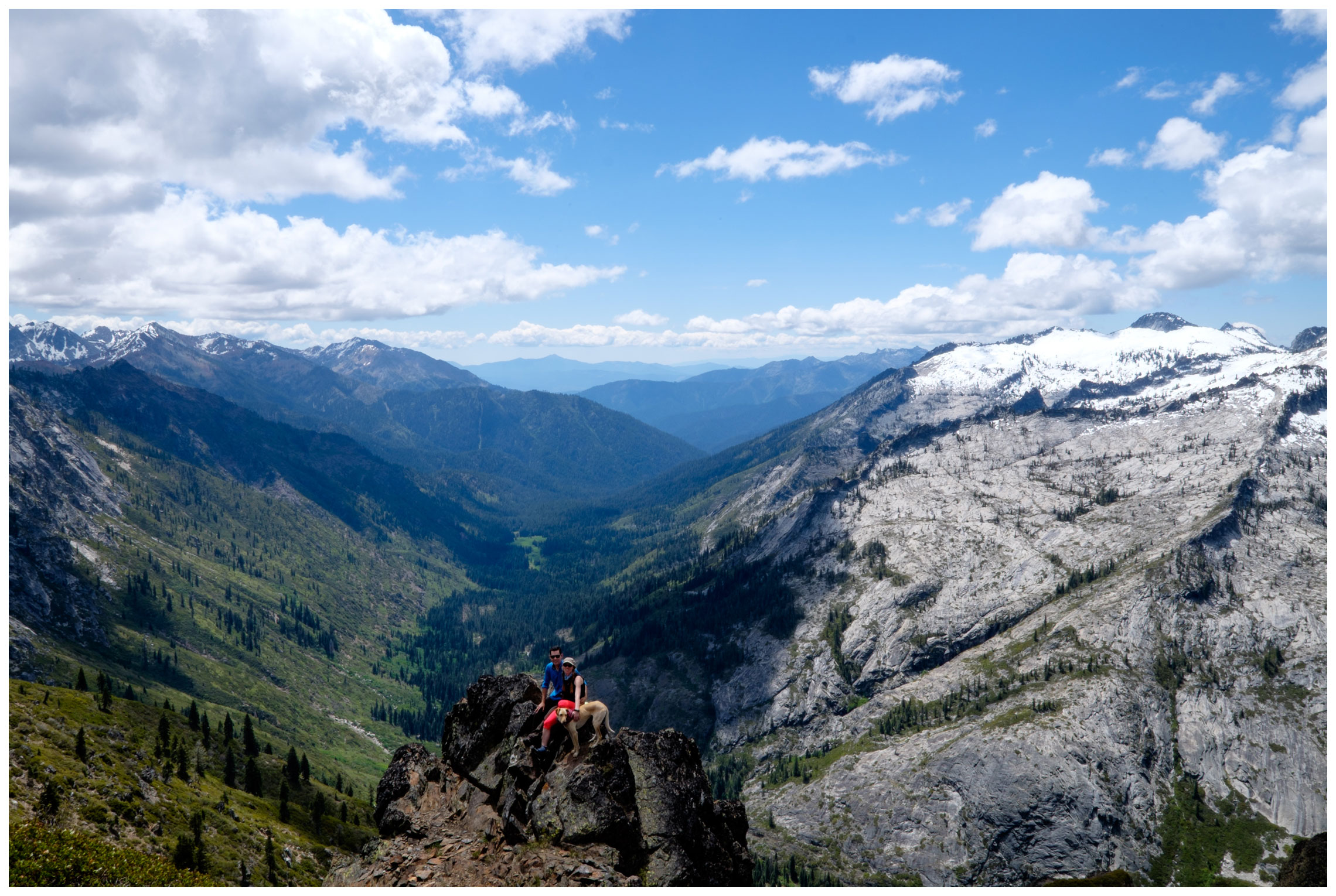 The view on the other side of Sawtooth Ridge is…vast. We spent at least an hour up top taking photos, exploring, and eating lunch. I really wanted to see what was up the canyon toward Emerald and Sapphire Lakes, but also wanted to get off the snow while it was still slushy from the sun, so I had to settle for a glimpse at Sapphire Lake around a rock outcrop.
 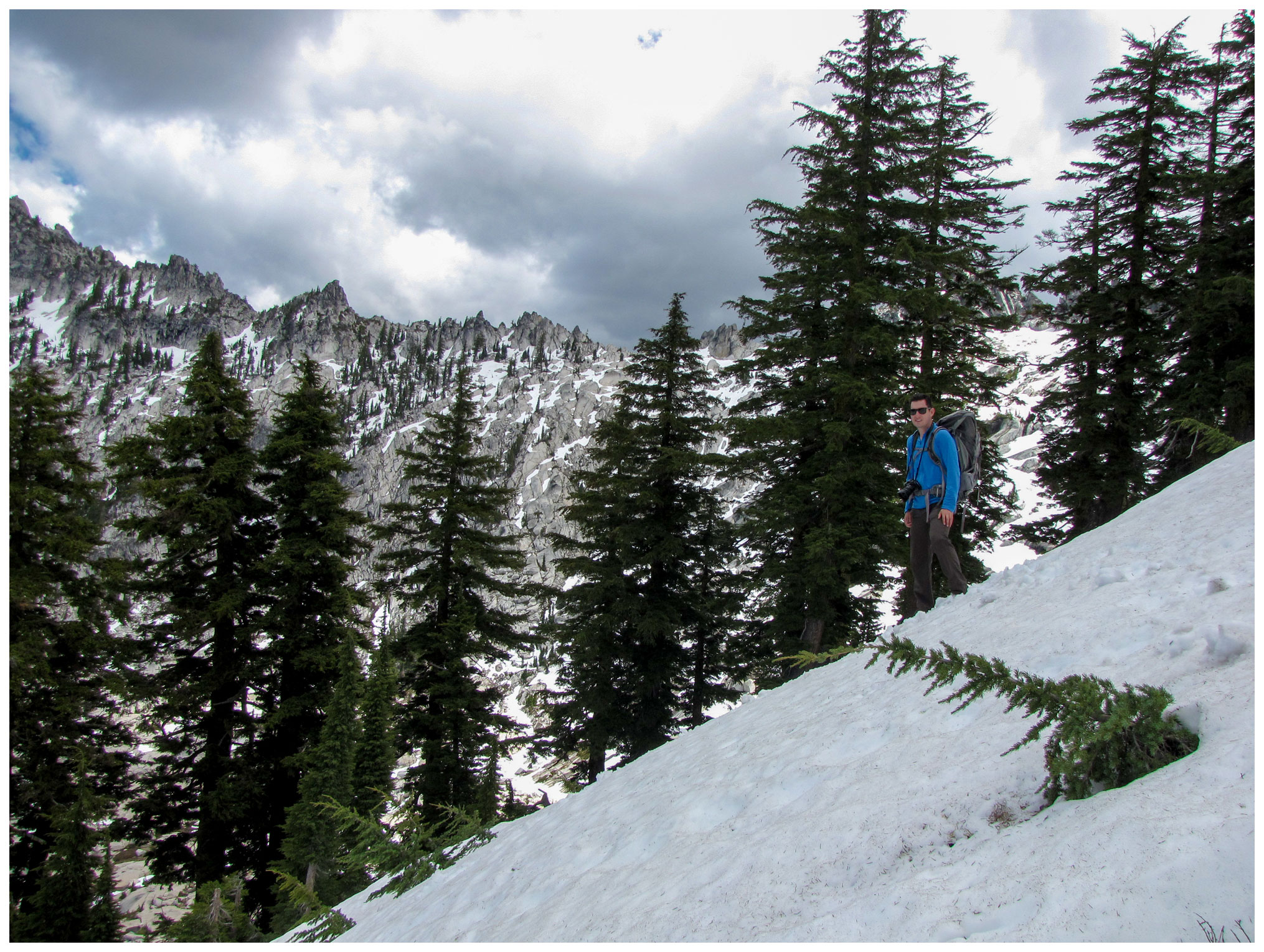 Thankfully the clouds came out for the descent to ease the glare off the snow. Once the grade became a bit more mellow we were able to half walk-half ski down the slope. If only I had my snowboard with me…
  On the hike out we decided to see what the old trail had to offer. My quads were feeling the burn on the climb from camp up to the saddle near Caribou Mountain. When we reached a section of decomposed granite I was missing the stairs trail crews typically build into Sierra trails, but the views of Caribou Basin were fantastic after we got above the trees.
 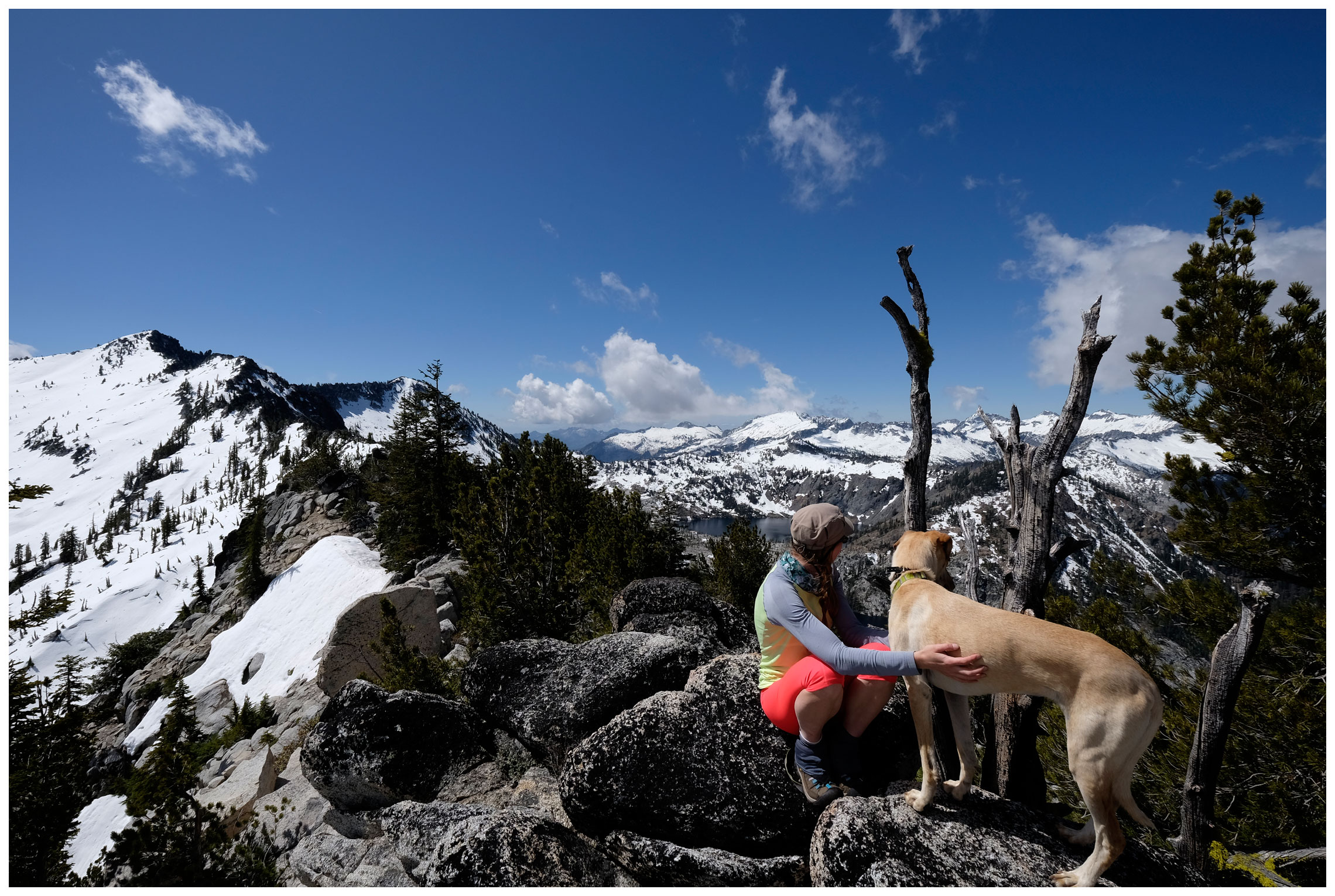 Originally we planned on taking a jaunt over to Caribou Mountain from the saddle, but the snowy conditions were too treacherous for such adventures. After a break at the top with one last look back we headed down the other side. There were a few snowfields to cross but we were able to navigate along the trail.
  Once we reached Caribou Meadow the old trail intersected with the new, but we continued straight along the old trail. It was nice and shaded, but toward the end I was ready for the beer waiting for me in the car and my boots to be off. Where is the end of this trial?! After what seemed like more miles than there should have been we reached the creek crossing. I slipped on my camp shoes waded across, sloshing back to the car carrying my boots. Lucky me, the beer was still cold.
 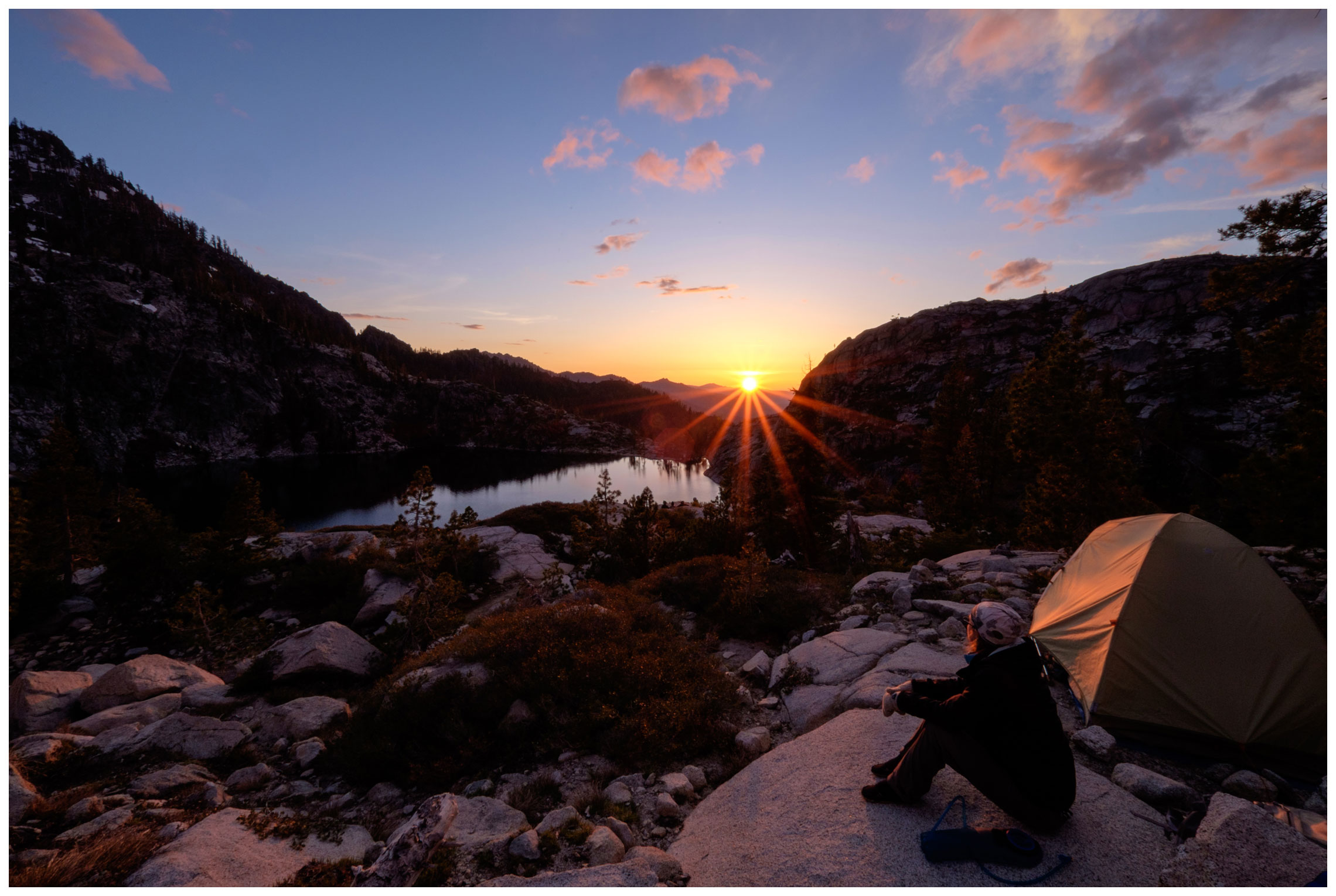 Looking back on our figure-eight hike, we both agreed that since we couldn’t reach Caribou Mountain from the saddle along the old trail we should have just hiked in and out via the new trail. The hike was easier going and the scenery was superb. Either way the views were full of mountains beyond mountains, no wonder this trail is so popular. For a more detailed trail guide see Summit Post: Caribou Lakes Trail.
Happy,
Trails
Note: Thank you to Compass for the majority of the photos and photo editing.

Pingback: Take Only Photos, Leave Only Footprints | Trails' Guide·
Hike sounds fantastic. I’d like to hike in America some day. I was wondering if – in America – hikers can camp anywhere along long trail like these? In South Africa that isn’t allowed. We have designated camping spots or cabins.
Hi Jacques, America has amazing options for backpacking! As for where you can camp along the trail – it depends. I feel like a majority of the wilderness areas are open to camping as long as you’re a certain distance from water. Other areas have designated camping areas. When you decide what mountains are calling you, I’d recommend giving the land managers of the area a call for details. Hope that helps.
Yeah it helps! It sounds wonderful to be able to camp anywhere you’d like. Anyhow, thanks for the reply.
Pingback: DIY: Adventure Pup Sleeping Bag | Trails' Guide·
Pingback: 2015 Blooper Reel | Trails' Guide·