
Destination: Lyons Lake
Mileage: Trails 10.36 miles, Aspen 17.5 miles
Trailhead: Lyons Creek on Wrights Lake Road off of Highway 50
Elevation: 6,740 to 8,415 feet
I checked the GPS in Aspen’s pack when we arrived at Lyons Lake – 10.5 miles. We were at our turnaround point and she’d already hiked more than I would all day.

Following her nose instead of the trail – click for larger PDF map.
This trail is great for a wide range of ages and abilities. As a young kid, I hiked along Lyons Creek with my family. We didn’t make it to either lake, but we ate lunch next to the creek and slid down the smooth rocks like a water slide. On the other end of the spectrum, the trail can be a launching point to summit Pyramid Peak.
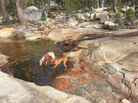
There are a few watering holes along the trail.
At 2.7 miles the trail forked for a more mellow .4 mile hike to Sylvia Lake at the base of Pyramid Peak or a quad-burning .5 mile up to Lyons Lake under lesser-known Mount Agassiz. On my Tom Harrison map, Lyons looked less vegetated and I’m all about the sweeping granite views, so we headed up.
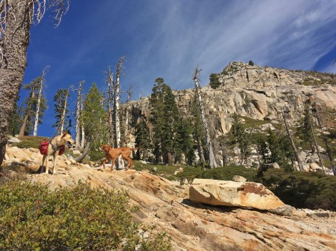
The climb to Lyons Lake.
Lyons Lake did not disappoint. I enjoyed the view while eating a lunch of avocado and rosemary bread – way fancier than my usual Clif Bar and trail mix. I would have loved to stay and explore the granite ridge lines around the lake, but we still had a little over five miles to hike back to the trailhead and apparently we didn’t cover miles nearly as fast as the two leggy dogs with us…

Dog party on a log in Lyons Lake.
Choose your own adventure,
Trails and Aspen
